

over- & undersampling
A detailed study on Equi7Grid's scientific background is published in this journal article. It introduces a Grid Oversampling Factor (GOF) metric to quantify local data redundancy when projecting satellite imagery onto regular raster grids. It evaluates common global, hemispheric and continental map projections to identify grid configurations that minimise oversampling while guaranteeing that no undersampling occurs.
The paper's key findings are:
- High resolution satellite remote sensing delivers unprecedented and evergrowing data volumes.
- Efficient spatial data handling is dependent on suitable map projections.
- The introduced Grid Oversampling Factor (GOF) estimates local data oversampling.
- Remarkably, equidistant projections are more suitable than equal-area.
- A global system of continental subgrids oversamples with only 2% (suggesting the Equi7Grid concept).
Motivated by preserving image quality and signal fidelity, the analysis focuses on how map distortions lead to pixel duplication and loss in the target grid:
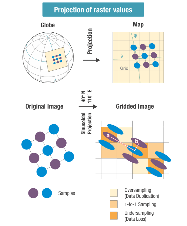
Oversampling spreads input values over multiple target pixels. Undersampling forces multiple input values into fewer target pixels, or even just one. While oversampling inflates data volume and is reversible, undersampling is more harmful — it irrecoverably impairs the signal.
Following this basic concept, the Grid Oversampling Factor (GOF) is defined and evaluated over various projections to measure data duplication. The evaluation with GOF intrinsically takes into account the minimal sampling necessary to prevent any undersampling in the target grid.
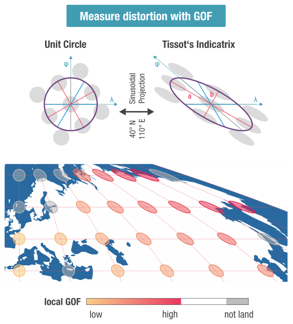
The figure above illustrates the analysis structure, where GOF values are determined for all land surfaces. In the shown example for the global Sinusoidal projection, the GOF values increase heavily towards the grid's periphery at high latitudes and longitudes.